05 / DRAWING TOOLS
The drawing tools a base camp actually needs.
Eight core tools — from a parking spot to a labeled holding zone, with snap and rotate built into each one.
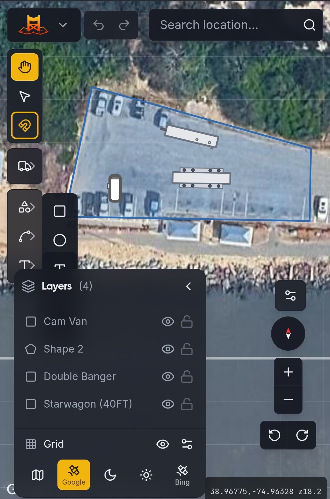
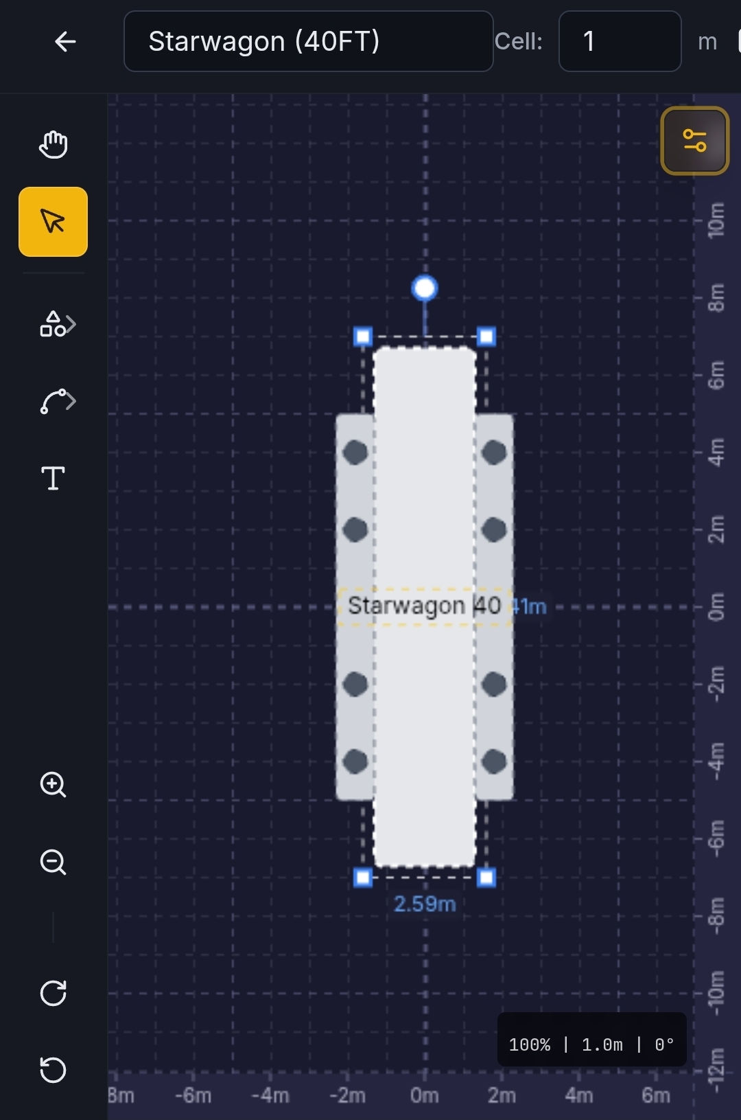
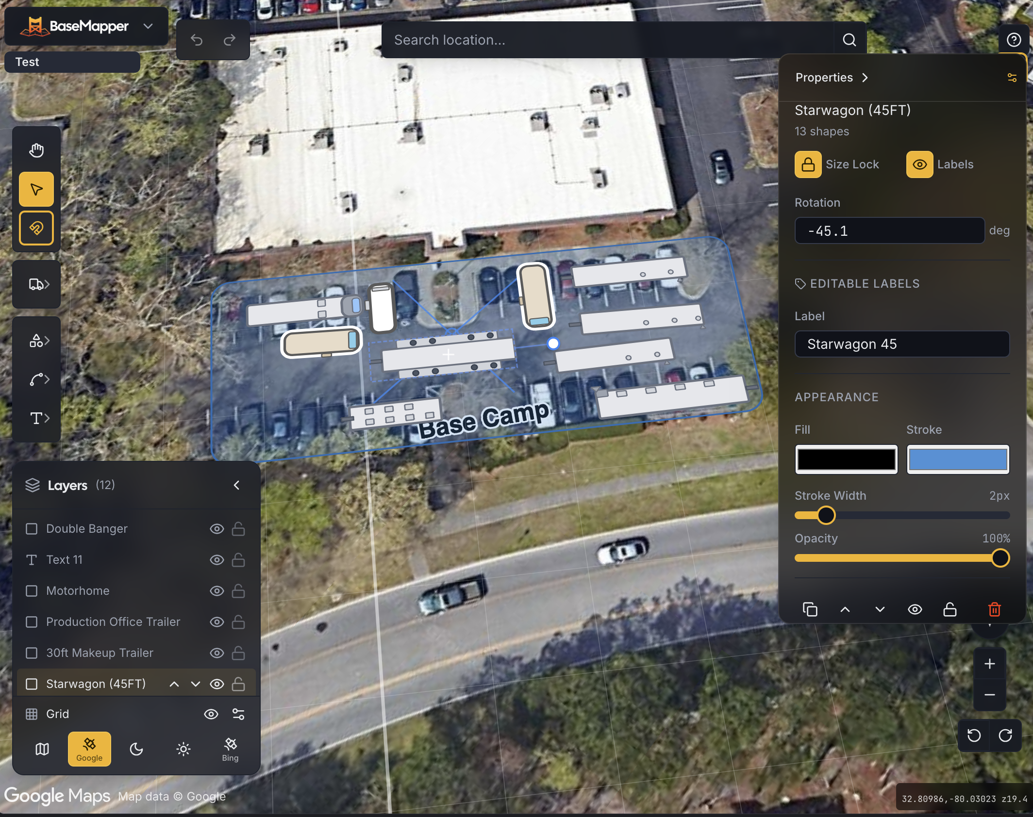
MoreThe map drawing tool built for location managers and UPMs, not repurposed from something else.Location managers have been drawing base camp maps in PowerPoint for years — no scale, no satellite imagery, just rectangles and guesswork. BaseMapper draws them on real satellite imagery, with vehicle templates at actual dimensions, snap-to-edge placement, and PDFs sized for the call sheet.
Get early access + 5 free production days
A quick tour of what makes BaseMapper feel different. Tap any card for the full story.
Eight core tools — from a parking spot to a labeled holding zone, with snap and rotate built into each one.
MoreDrop in real production vehicles, lighting rigs, and camera tech at their actual dimensions.
MoreMarquee or shift-click to grab a group. Bulk move, delete, or tint by department.
MoreEdges, centers, and vertices win first; the grid catches what's left.
MoreBuild multi-page sign sets right next to the layout. Print-ready PDFs sized for the field.
MoreA real touch UI built for the lot — bigger hit areas, gesture-driven editing, tap-to-select that works on a phone screen. Drag a vehicle where it actually parked.
More"We used to draw parking maps in PowerPoint the night before scout. BaseMapper is what we use now — it's faster and the transpo coordinator actually trusts the dimensions."
Sarah M.
Location Manager
"The vehicle templates are the right size and there are enough of them to cover a real base camp. That's harder to get right than it sounds."
Michael R.
UPM
Join location managers and UPMs getting early access.